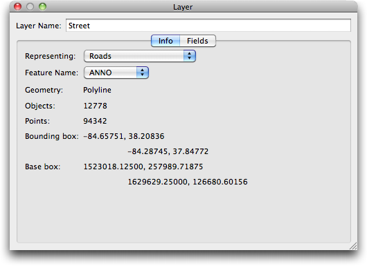
From the Layer Info Window click the Info Tab. The Info tab appears.
The Info tab displays some additional information about the Layer.
- Representing
This pop-up menu describes the information that this layer represents. This serves only as a guide for the software and for users.
- Feature Name
This pop-up determines which column in the data for this layer is used as the feature name during display. This affects certain output formats (such as KML) which have use for a name field and is displayed in Data Tool Tips.
- Geometry
Describes the type of features represented in this layer. Possible values are: Point, Polyline, Polygon, Image.
- Objects
Provides a count of the number of features in this layer.
- Points
Provides a count of the number of points in all features in this layer. This is a rudimentary measurement of complexity.
- Bounding Box
Shows the upper left and lower right coordinates of the bounding box in map coordinates.
- Base Bounding Box
Shows the upper left and lower right coordinates of the bounding box in layer coordinates.
