Because CartoMobile is designed for field data entry, it is built on a sophisticated form system. When adding or changing attributes for a feature, CartoMobile displays that feature's form. Each Data Layer may have its own individual form, allowing you to intermingle different types of data in the same Map.
Each form contains one or more fields that allow for the display and modification of data.
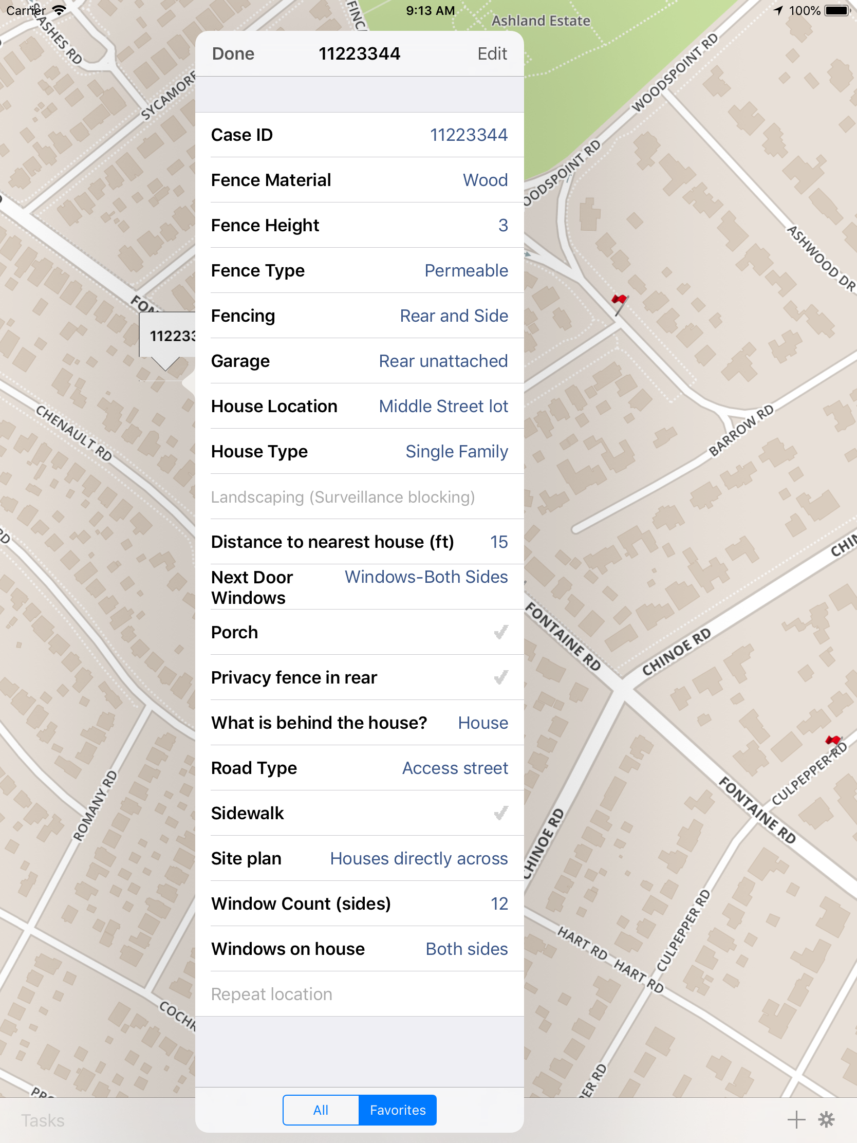
Forms connect data storage to data presentation, providing context and limits to the input by the user. CartoMobile's field types include:
- TextBox
A long (up to 255 character when stored locally) text field
- SingleText
A short (one line) text field
- CheckBox
A simple yes/no (1/0 or on/off) selection.
- ChoiceList
A choice list provides a map between a human-readable label and the value which is stored. The values represented by the choice may be either numeric or string values. Often, a choice list is preferable to open text selection, because it provides consistency in data entry.
- StreetAddress
A text area to input street information. Street Address fields will call out to the Maps application for directions if you tap and hold on them. In advanced versions of CartoMobile, street address fields can be filtered based on street data.
- Number
A field for entering Numbers (integers or floating-point).
- TimeStamp
Combined date and time for things such as marking the time a feature was created.
- Date
A simple date field.
- Time
A simple time-of-day field.
- Picture
Storage for a picture taken with the device or stored on the device. See later documentation on how to use these in other GIS applications.
- GPSLocation
A field for presentation of the GPS Location represented by the object. This is valid only for point layers, as all other layers have more than one location.