Another tool in Cartographica for promulgating attributes between layers is the Overlay Operations tool. This tool, and its associated operations, provide a way to manipulate both the attributes and the geometry of layers. Each overlay operation has a different geometric effect, and can also contribute attributes to the target layer(s).
Spatial Joins are used to combine the data attributes of two or more layers. The Spatial Join operation creates a new layer that is a combination of attributes from Join and Target layers. The Spatial Join functions are akin to the Overlay functions except that the Spatial Join procedure does not change the geometry of the layers. Spatial Joins can be used for many different purposes and there are many options for determining how the join will be processed.
A Spatial Join can be performed on point, line, or polygon layers. The resulting vector layer will match the Selected layer's data format (i.e. point, line, or polygon). For example, if you select a polygon layer and then perform a Spatial Join (using an Intersect function) with a point layer as the Join layer, the output would be a polygon layer with attribute data joined from the point layer. In this case one attribute added to the polygon layer would be a count of the number of points that intersected with each polygon in the Selected layer.
The default Spatial Join option is the Intersection function, which will join two layers that overlap in space. In addition to the Intersection function there are 15 additional methods for performing Spatial Joins that can be used to fit various situations.
Table 8.4. Overlay Operations
|
Operation |
Description |
|---|---|
|
Clip |
Target layer features are clipped to the features in the clipping layer. |
| Erase | Erase the target layer(s) with the erase layer. Portions in the target layers that match the erase layer are removed. |
|
Intersect |
Features that overlap with all target layers are maintained. Note that this differs from clipping in that features are removed if they aren't present in all layers. |
| Union | Features in all Target Layers are kept. Overlapping features are combined. |
|
Difference | Features present in more than one layer are removed (possibly partially) to result in a layer that contains only the pieces of features that are only present in a single layer. |
| Update |
Target layers are updated with geometry in the Update layer. Overlapping geometries will be replaced, and non-overlapping geometries (or parts thereof) will be retained. |
|
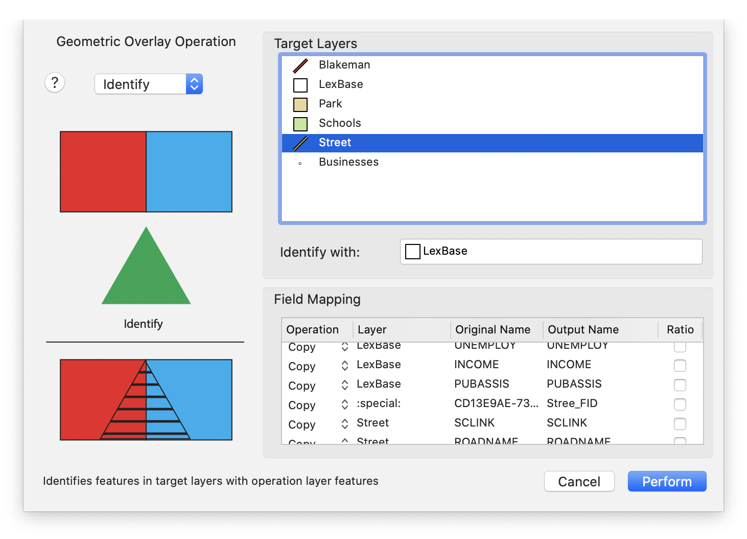
Identify | Target layers are identified with the geometry in the Identify layer. Overlapping geometries will be updated to contain information from the Identify layer. Partially-overlapping geometries will be split into overlapping and non-overlapping parts. |
Performing Overlay Operations
Choose > .
The Overlay Operation sheet appears
Choose from one of the Overlay operations (discussed previously in Table 8.4, “Overlay Operations”)
Select your target layer(s) in Target Layers
If appropriate, drag an operation layer from the Target Layers box to the operation box (which will be labeled according to the operation)
Adjust your Field Mappings as appropriate. Operation is identical to the Field Mapping section.
Click
Once the operation is complete, new layers corresponding to the Target Layers should appear in the Layer Stack.