The Layer Info window shows the data features of the layer that is selected. It is used to add/remove columns, change data types, and modify column names. To access the Layer Info window, choose > . The Layer Info window appears showing the Fields tab.
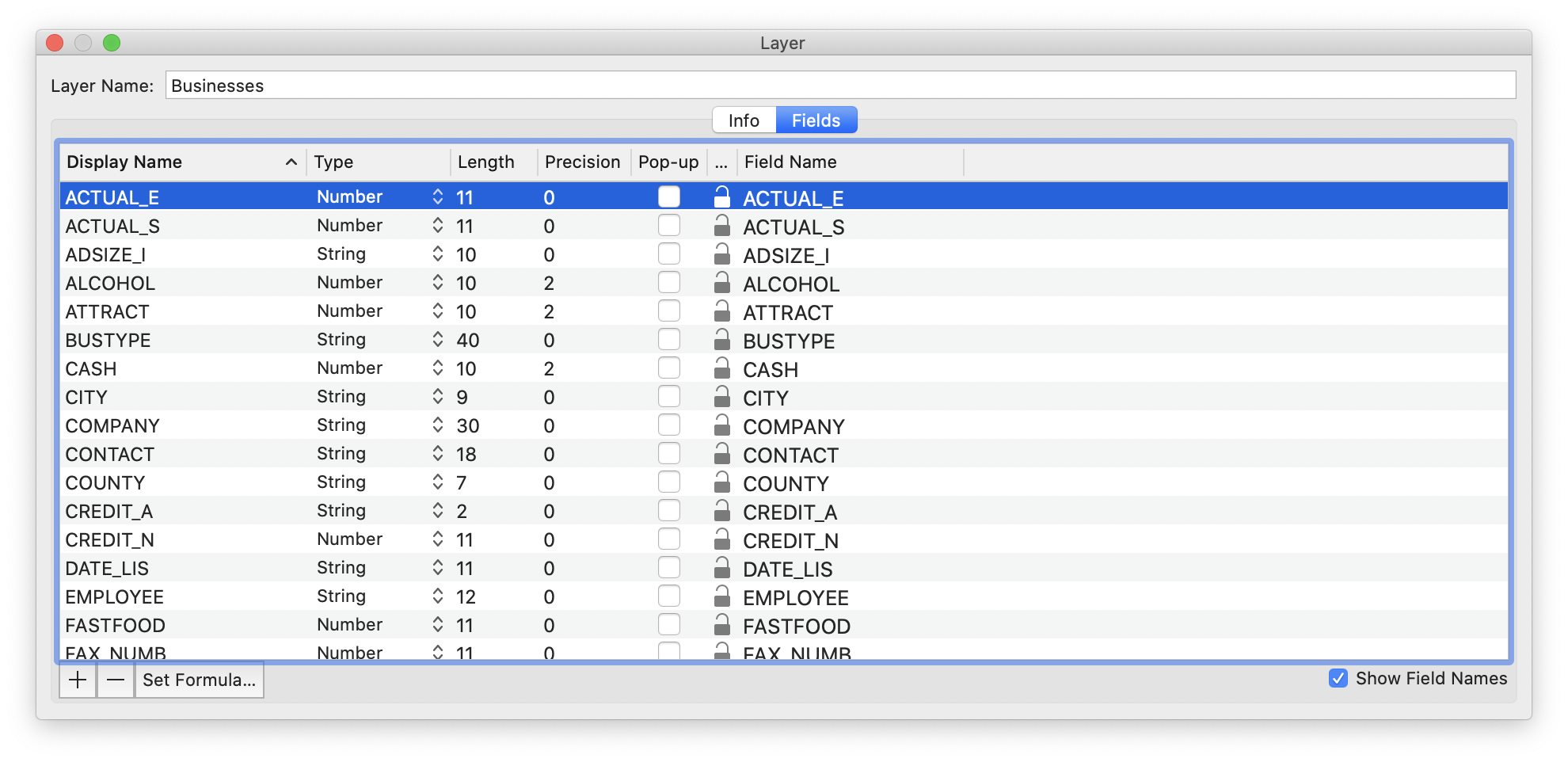
The Layer Info window is a live window, so you can make changes to the layer by editing the values in it. Here is a description of each of the columns in the Layer Info window and their purpose.
Table 5.1. Layer Info Window Columns
| Display Name | name used by the Data View and the Legend, and has very few practical limitations, other than needing to be unique. |
| Type | Type of the data in this column. This determines how the data in the column is to be interpreted by Cartographica. Possible types are: String, Float, Number, Boolean, and Date. |
| Length | The storage length for this column. This will determine the maximum length of a string, the maximum number of digits of a Number column, etc. Float, Date, and Boolean should be left at the system suggested values. |
| Precision | For the Number column (fixed digits), this is the number of digits of the Length field that are dedicated to numbers after the decimal point. |
| Pop-up | If this is checked, this column is used in the Pop-up preview (for example, if you hover over a feature) |
| Lock | Determines if this field is locked. This is mostly used with the calculated formulas (see Column Formulas) columns, as it will prevent these from being re-calculated. |
| Field Name | This is the actual data storage name internally. Generally, you're better off not to change these unless you know you're going to be re-exporting SHP-file data and you need to match column names with other software. |
For example, to change the Display Name (the name that shows up in the Data View)
for ACTUAL_E, click on the word and then type a new name.
Similarly, the length, precision, and type of data can be manipulated by making changes to those columns.
![[Note]](Graphics/note.svg) | |
If you change a column's type, Cartographica will attempt to coerce the data in that column to the new type, but that may not always be possible. Take particular care when converting textual data to numbers, as you are likely to end up with many 0's if the data cannot be reinterpreted. |