Cartographica can perform basic and advanced cluster analysis based on a number of parameters. The overall algorithm used is DBSCAN, which is a progressive algorithm that is efficient and can find cluster patterns that elude other algorithms with a minimal amount of pre-configuration. This makes the algorithm particularly good for experimental or preliminary analysis, while still remaining effective for detailed analysis.
![[Note]](Graphics/note.svg) | |
Cluster Analysis is for dealing with Point features, and cannot be used with other geometry types. |
Performing a Cluster Analysis
Select the Layer that contains the points you want to cluster
>
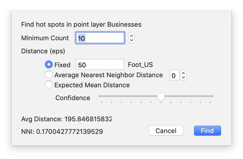
The Find Clusters sheet will appear
Shortly after the sheet comes up, the Average Distance (average nearest distance for points in this layer) and NNI (the Nearest Neighbor Index–a value describing how likely it is that the data forms clusters; if the value is <1 it is likely clustered).
Adjust the Minimum Count to be the minimum number of points in a cluster
There are 3 distance functions that can be used in determining whether a point can be clustered with other points, of which you must choose one:
distance will be in the coordinate system of the Map (which is consistent with Cartographica analysis tools)
is based on the average nearest neighbor distance, and the value with the stepper indicates the number of standard deviations to include
is based on a confidence interval based on the expected density of the area
The techniques, and especially the Expected Mean Distance confidence intervals are modeled on those used by CrimeStat.
Finally, when you are satisfied with the parameters, click
The result layer will be added to your map as a new Polygon layer with a name based on the name of the layer to be analyzed